


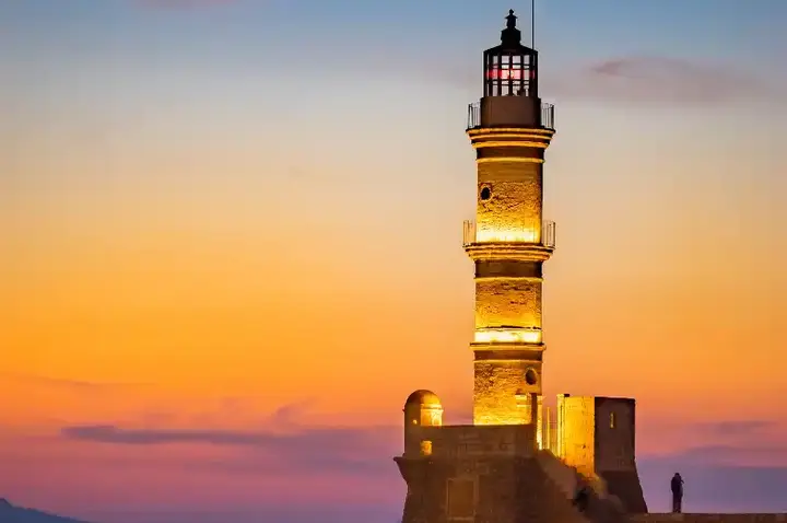
Unveiling the captivating past of the lighthouse of Al-Ayjah


The location of the lighthouse is strategic. The geography of its altitude makes it visible from the sea and alerts ships and naval fleets to enter an ancient port on the global navigational map.
Show key points
- The Al-Aijah Lighthouse is strategically located in Ras Al-Mil, making it highly visible from the sea and aiding ships navigating toward the ancient port of Sur.
- Historically, the lighthouse was a defensive structure with a semicircular wall and cannon windows, only three of which remain today.
- The name "Mile Head" derives from the area's geographical resemblance to a ship’s bow, emphasizing its maritime significance.
- ADVERTISEMENT
- The local area near the lighthouse is called "Al-Jila," meaning a high place above water, though the term is not widely recognized outside the region.
- Contrary to popular belief, the lighthouse was not built by the Portuguese, as Al-Aijah was uninhabited during their invasion.
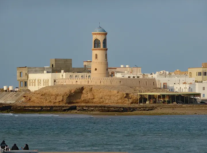
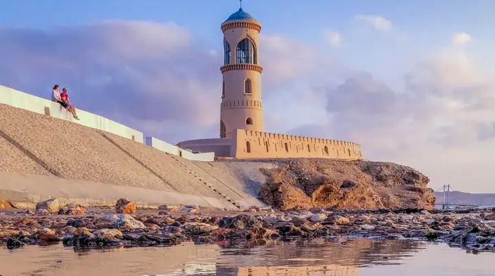
- In 1996, under the orders of Sultan Qaboos, the lighthouse was reconstructed and expanded to mark National Day celebrations, and was later named Manarat Al Eija.
- Featuring traditional Omani architectural elements, the current lighthouse stands as a three-story structure with a vaulted ceiling and symbolic inscriptions over its entrance.
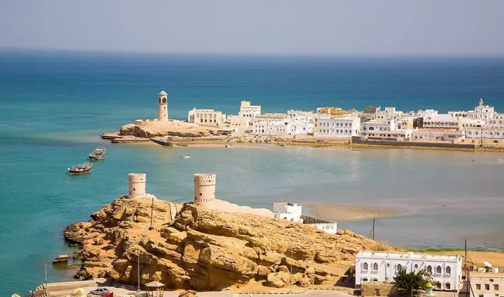
The lighthouse of Al-Aijah is located in Ras Al-Mil, which extends on the coast of Sur overlooking the Arabian Sea and the Sea of Oman. Mile head is a local name meaning ship head as its shape resembles a ship's bow. Ships enter through Khor Battah, and due to the narrowness of the creek, the lighthouse provides important assistance to facilitate proper navigation of the water.
In the past, the lighthouse was very different from what we see today. It was just a construction surrounded by a semicircular wall "whose purpose is to protect and defend the entrance to the creek and the surrounding area."
Recommend
Ahmed bin Muslim al-Alawi, a citizen familiar with the history of al-'Aija, said: "The walls also had strategic windows in which cannons and rifle barrels were installed, and only three of them remain to date."
He added: "The vicinity of the lighthouse is locally called "Al-Jila" and for residents it means "the place that is high above the water." "While locals call it that, not many people know it," Alawi said.
Sheikh Hamoud bin Hamid al-Ghailani, a historical researcher, said the simplest firewalls in al-Jila were up to 130 centimeters.
"Some attribute the construction of the lighthouse to the Portuguese, but this information is incorrect. During the Portuguese invasion, Aija was still uninhabited."
During the Renaissance in the early nineties and the first decade of the twenty-first century, the simplest form of jela was handed over to the Diwan of the Royal Court. At that time, His Majesty Sultan Qaboos, may God rest his soul, ordered the construction of the lighthouse in 1996 to coincide with His Majesty's celebration of the National Day in the state of Sur.
During this renovation, more space was added and the designs were improved with the walls properly built and lifted from the sea. This development eventually led to the lighthouse structure we see today including the addition of the night lighthouse. Once the project was completed, it was finally named Manarat Al Eija.
Today the lighthouse consists of three floors and a vaulted ceiling. On the door there are inscriptions indicative of beautiful traditional Omani architecture.
There are still a lot of things to discover about the generation, but so far, the things I have learned have proven the foundations of the long history of the place and lighthouse. At night, the lighthouse, with its dim light, reminds passers-by that they are in one of the most beautiful coastal cities in Oman – the city of Sur that continues to grow and charm.
