The City of Qacentina, why is it A MUST to visit when in Algeria?

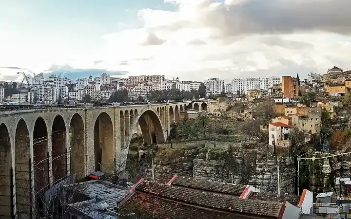
Constantine, a city in northeastern Algeria. A natural fortress, the city lies on a diamond-shaped rocky plateau, surrounded, except for the southwest, by a steep gorge through which the Rhumel River flows on its eastern side. The plateau rises 650 meters above sea level and ranges between 150 and 300 meters above the riverbed in the valley. At its narrowest point, the valley's slopes are separated by a distance of 4.5 meters, while its maximum width is about 365 meters. The valley is crossed at the northeastern corner of the city by the El Qantara Bridge, a modern 130-meter-long structure built on the site of earlier bridges. North of the city are a suspension bridge and an overpass, respectively.
Recommend
Show key points
- Constantine is a historically rich city in northeastern Algeria, dramatically perched on a rocky plateau surrounded by deep gorges carved by the Rhumel River.
- The city dates back to prehistoric times and rose to prominence as Cirta, the capital of Numidia and later a major Roman colony after Julius Caesar's rule.
- Constantine has endured and thrived through various regimes including Roman, Arab, Turkish, and French, accumulating a mosaic of architectural and cultural influences.
- ADVERTISEMENT
- The city's iconic bridges, such as El Qantara and the Birago Bridge, highlight a blend of ancient crossing points and modern engineering achievements.
- Constantine is an educational hub with several major universities, including the Salah Boubnider University, the largest in Africa.
- Unique cultural practices, such as women wearing black haika in mourning since 1792, reflect the city's deep-rooted social customs.
- With a Mediterranean climate, scenic views, historical landmarks, and accessible modern infrastructure, Constantine offers a compelling destination for travelers.
A City That Wrote History's Chapters, From Caves to Castles
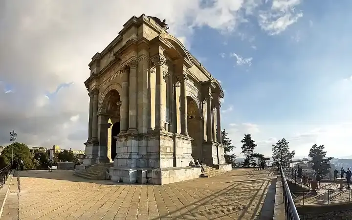
Caves in the walls of the Wadi Rommel indicate the presence of prehistoric settlements. By the 3rd century BC, Cirta, or Cirtha (from the Phoenician word for "city"), was one of the most important cities of Numidia and the seat of the Massilian kings. Under Micipsa (2nd century BC), it reached the height of its prosperity, able to field an army of 10,000 cavalry and 20,000 infantry. Cirta became a Roman settlement under Julius Caesar and later became the leader of a league of four Roman colonies on the North African coast. During the Roman Emperor Maxentius's war against Alexander, the Numidian usurper, the city was destroyed. Upon its restoration in 313 AD, it was renamed after its patron, Constantine I the Great. The city survived the Vandal invasion of Africa but fell to the Arabs (7th century). During the 12th century, it maintained its prosperity despite repeated plundering, and its trade expanded sufficiently to attract merchants from Pisa, Genoa, and Venice. Although repeatedly captured and then lost by the Turks, it became the seat of a bey of the Dey of Algiers. Salah Bey, who ruled Constantine from 1770 to 1792, greatly improved the city and was responsible for the construction of most of its existing Islamic buildings. Since his death in 1792, women of the area have worn a black haika (tent-like garment) in mourning, rather than the white haik commonly worn in the rest of Algeria. In 1826, Constantine asserted its independence from the Dey of Algiers. In 1836, the French made an unsuccessful attempt to storm the city, suffering heavy losses, but the following year they succeeded in capturing it with another assault. In World War II, during the Allied campaign in North Africa (1942-1943), Constantine and the neighboring city of Setif were important command bases.
Is Constantine, Algeria, worth a visit?
Constantine boasts a rich history, stunning scenery, and culture. The city is easily accessible via its international airport, Mohamed Boudiaf, located 9 kilometers south of Constantine. For those seeking truly unforgettable adventures, the city is well worth a visit.
Who built the bridges in Constantine, Algeria?
The Birago Bridge was built by French engineer Ferdinand Arnodin in 1962. It is 125 meters long and is believed to be a miniature version of the Sidi M'Cid Bridge. The new cable-stayed Constantine Bridge was designed by the renowned architectural firm Dessing-Weitling and completed in 2012.
Why is Constantine a special city?
Constantine was the first emperor to allow Christians to practice their religion freely, contributing to the unification and spread of the faith. He also initiated the celebration of the birth of Christ, known as Christmas. In 314 AD, a year after Constantine's edict of religious tolerance, the first bishop of Aporakum was ordained.
Education
Constantine has four universities: two in the city center: the Mentouri Public University, designed by Brazilian architect Oscar Niemeyer and Algerian architect Rachid Hussein, as well as the Zerzara Pole for Technical Engineering and the Zouagi Slimane Pole for Geography and Earth Sciences. In El Khroub, there is the Institute of Veterinary Sciences. Emir Abdelkader University is one of the largest Islamic universities and includes several faculties covering religious studies, foreign languages, and literature. The new city of Constantine, known as the New City of Ali Mendjeli, has two major universities: the University of Constantine 2, known as "Laylat N'Soumer," offers majors in mathematics, computer science, and economics. It is a university campus with over 20,000 students, 17 faculties, and over 40,000 residents. It is now the largest university in Africa, under the name of Salah Boubnider University.
A Mosaic of History and Identity on the Bridge of Time
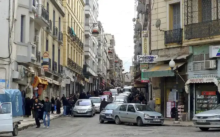
Constantine enjoys a Mediterranean climate, with hot, dry summers and mild, humid winters. Constantine is walled, with most of its medieval fortifications built from Roman building materials. Rue Didouche Moutad, which runs along the steep slope of the plateau (from northeast to southwest), divides the city into two sections. To the west lies the Kasbah (the old citadel), with its Roman-era sections, the Souk el-Ghazal Mosque (which the French converted for a time into the Notre-Dame de Sept-Dolor Cathedral), the Moorish-style Ahmed Bey Palace, and administrative and commercial buildings. The straight streets and wide squares of the western sector reflect French influence. The eastern and southeastern sectors offer a striking contrast, with their winding alleys and Islamic architecture, including the 18th-century Salah Bey and Sidi Lakhdar mosques. In this sector, each profession has its own district, with entire streets dedicated to a single craft. The University of Constantine was founded in 1969; other institutions include the Cirta Museum and the Municipal Library. Suburbs have developed to the southwest of the city on the "isthmus" leading to the surrounding countryside. Newer developments are to the east across the Strait of Rmel. Apart from a factory manufacturing tractors and diesel engines, industry is mainly limited to leather goods and woolen fabrics. Considerable trade in agricultural products, especially cereals, is carried on with the High Plateaus and the arid south. The population in 1998 was 462,187; the 2008 estimate was 520,000.